Pat and Ron's Travel Adventures

Pat and Ron's Travel Adventures

Welcome

We invite you to share our travel adventures as we seek out new experiences, sights, foods, and cultures. We regret not being able to write each of you individually and so we try to stay in touch this way. We love hearing back from you.
Happy Trails!

Friday, December 30, 2016

Andes Mountains in Ecuador

To the Ecuadorian people, every day, except for maybe the rainy season, is the same as every other. The sun shines around 12 hours a day and the temperature varies little. Crops, flowers, trees, and all flora go through their cycles continually and something is always in bloom. The people are either of Spanish, or indigenous, or both (mestizo) descent. There are several different cultures and all dress in their regional unique, brightly colored styles regardless of the activity. To us they looked too bulky and warm for the daily temperatures. The country is predominantly Catholic (as expected) and, therefore, there are many churches all elaborately decorated with Spanish architecture and gold, baroque style interiors.  

The Andes divides Ecuador and lies between the coastal (Pacific Ocean) and the Amazon Jungle. The Andes Mountains are the longest continental range in the world and extend 4300 miles (7000km) through 7 countries. This Highland region of Ecuador has an average elevation of over 15,000 feet (4.5km) with over 30 volcanoes, hot springs, cloud forests and the Andean Condor. The Highlands are populated with small isolated villages since travel is so difficult. Llamas are an often seen necessity as are the many markets to exchange goods (woven material, metal crafts, woodcarvings, dough figurines, and embroidery) and fresh food (fruits, vegetables, meat).

We found the Ecuadorians to be friendly, to be hard working, and to enjoy life. They have many more festivals and days of celebration than in the US, reminding us that our society values working hard more than enjoying life. The Ecuadorians are dark complexioned and black haired.  We didn’t remember standing out so much since being in China. We were told that, if someone was looking for us, that they would look for the red and white haired couple!! It worked.

Our trip was loaded with delightful experiences which exceeded our expectations (except for seeing flamingos in the wild). We found the people pleasant, happy, and delighted to return a smile and a greeting. We hope that these photos convey these thoughts.


This concludes our 3 part blog on Ecuador, so until next posting “Happy Trails” and remember that we would love to hear from you. 
Andes

Sunday, December 25, 2016

Ecuador Amazon

The Amazon is the largest river on Earth extending over 4,345 miles (7000km.) The mouth of the river can be 120-250 miles (195-400 km) across in the wet season and large ships have no issues with travelling up river all across Brazil and into Iquitos Peru [2300 miles (3700 km) taking 23 days] from the Atlantic. The Amazon, with all its tributaries, makes up the Amazon Rainforest (also referred to as Amazonia or the Amazon Jungle) and is the largest on Earth. It covers 40% of South America and has a mind-boggling area almost the size of the US (see photo). The Amazon begins in the numerous rivers formed in the Andes in Ecuador and Peru.

One in ten known species in the world lives in the Amazon Rainforest as does one in five bird species. It is home to 427 mammals (e.g. jaguar, sloth, river dolphin), 1,300 birds (e.g. macaw, toucan ), 378 reptiles (e.g. anaconda and Jesus lizard) and more than 400 amphibians (e.g. glass frog and poison dart frog.). Amazonia is synonymous with diversity. In forests elsewhere on Earth, one’s view may include 2-3 of the same species of trees, yet the same view in Amazonia would yield a view of 30-40 different species.

With that in mind, we wanted to include a trip to Amazonia while we were in Ecuador. We flew to the town nearest the jungle (Coca) then boarded a boat onto the Napo River which flows into the Amazon River (along with a bazillion others.) There are next-to-zero roads and the river is the highway. Everything is transported via high-speed motorized canoes or barges. We wanted to go at least 60 miles (100km) into the jungle, which required a 2 ½ hour ride in a canoe powered by twin outboard engines going as fast as they seemingly could, then a short hike through the jungle to a manual canoe ride (paddled by 2 indigenous men), up a narrow creek into a lagoon, to get to our backcountry resort within the Kichwa Territory.

We hiked on the muddy trails through the jungle, climbed an observation tower to the jungle canopy, and took canoe trips (both day and night) up narrow creeks and into the lagoons in search of wildlife. The jungle did not fail to provide its splendor. We were treated to seeing 3 of the 5 species of monkeys, a sloth, reptiles, bats, insects, fish, and fauna up close and in their natural surroundings. Thankfully we did not encounter the kinds that can kill you, and there are many of those! We also visited the Kichwa in their homes, villages, and school. In the Rainforest live between 2-4 million indigenous people, 96% of whom are Kichwa. The Government gave the indigenous large parcels of land with the provision that it cannot be sold. They live quite isolated from modern society and live primarily on fish and yucca plants. No internet!

The weather certainly emphasized that we were in the rainforest. While it only truly rained on our trip into and out of the jungle, the high temperatures and even the higher humidity reminded us daily that we were definitely in a rainforest. It is a wild, remote, sparsely populated place and we are so glad we were able to experience it. We were sad to leave this part of our trip and also so glad that we added this adventure to our experiences. We hope that the photos show that. We have added descriptions to each photo to help describe them.

Our next posting with be a wrap up of our impressions of Ecuador, focusing on the Andes, the people, culture, and towns. Amazonia

Friday, December 16, 2016

Galapagos Islands

The Galapagos archipelago was created from volcanoes, much like Hawaii. It consists of 13 major islands and is located 600 miles from Ecuador to whom it belongs. The Galapagos Marine Resources Reserve is the world's 2nd largest, after the Great Barrier Reef. They have flora and fauna that is found nowhere else on the planet, and different species on each island. For that reason, they have strict regulations of what can come in or out of the islands and how many people can be in any one place at the same time. They even sprayed the overhead compartments in the airplane with an insecticide before landing. Charles Darwin came up with his theory of evolution by natural selection from studying the fauna on the islands. The famous “Darwin Finch” is now 13 different species. The tortoise has become the symbol of Galapagos and are the world’s largest tortoises. Drought is happening there too and sometimes the tortoises have to travel several miles inland in search of something green to eat. On another island, it was greener and food was more plentiful for them. Other daily sightings were of sea lions, colorful crabs, iguanas, marine turtles and tons of birds. Snorkeling produced countless sightings of colorful fish and coral, rays, eels, marine turtles, even a shark, and the younger sea lions found it fun to swim with us. After our Galapagos segment, we traveled to the Amazonian jungle, down Ecuador’s largest river, which will be our next blog. Galapagos

Sunday, October 16, 2016

Along the Nez Perce Trail

The Nez Perce (Nee-ME-Poo) are an Indian tribe in the Pacific Northwest. The name Nez Perce (pierced nose) was a name given to them by the French fur traders. Since they did not have pierced noses, the name probably came from some similar sounding word. Their first recorded encounter with the white man was with the Lewis and Clark expedition. The meeting was friendly, but as time went on,and as the US is historically known to do, the relationship went pear shaped. By 1877 they were at war with the US 7th Calvary after suffering abuses by the US.  Rather than be moved to Oklahoma, they took off on what today is known as the Nez Perce Trail. It is now a National Trail and is in western Oregon, Idaho, Yellowstone, and Western Montana. Since our summer travels crossed and followed this trail, we learned about these people and learned about their plight. Their story, although not unique, moved us so we decided to entitle this blog after this Trail.

Our summer travels took us from the Columbia River to the Clearwater, the Lolo, the Snake, the Clark Fork, and the Salmon Rivers. We traveled from the Blue Mountains in the west over the Lolo Pass through the Bitterroots, south to the Sawtooth Mountains, and east to the Rockies. The summer was cool and generally dry up there. We discovered remote campsites near these rivers with backdrops of the mountains on the horizons. Spring and summer wildflowers were our constant companions along with the sounds of the rivers.

We hope that you enjoy going along with us in our photos and we would love to hear from you.

Saturday, December 26, 2015

Australia

Down Under 
Australia is the world’s smallest, flattest continent and largest island, with almost 70% of its land mass below the Tropic of Capricorn. The island continent separates two great oceans: the Pacific and the Indian. 70% of Australia’s population lives in 10 cities so wide open spaces are still plentiful. Australia is about the size of the US but with only 24 million people. We went there with the objective of seeing as much endemic wildlife in their native habitat as possible, and to seek out what was unique to Australia that we may not see elsewhere. We tried to capture as much as we could in photographs, but not at the expense of getting an experience to remember.

One joyful experience was the nightly march of the Little Blue penguins from the sea to their burrows.  These penguins are the smallest species of penguins, only 13” tall. They wait until it’s dark enough to avoid predators, then come out of the ocean in groups (safety in numbers) and start their waddling journey back to their burrows.  Some walk quite a long way for their little legs (up to one mile!)

We snorkeled on the Great Barrier Reef and marveled at the fish and more types of colorful coral than we have ever seen elsewhere. We went wombat-searching one night even though we’d never even heard of the nocturnal wombat prior to this trip. They are native to Australia, a muscular marsupial, although their pouch is backward-facing so when they dig, their baby doesn’t get buried in dirt. We saw 4 that night and were gifted with one Wombat walking by us only 3 feet away so we could see she had a joey in her pouch. This was a real treat and a rare spotting.

We were treated to so many sightings of species which exceeded our already high expectations. We saw (1) mobs of marsupials, including macropods ( kangaroos and wallabies), hundreds of huggable koalas sitting in eucalyptus (gum) trees, and wombats; (2) the egg-laying-mammal echidna or spiny ant eater; (3) tons of bird species; (4) Fruit bats or “Flying Foxes”; (5) four species of penguins; (6) Fur seals and sea lions; (7) Emus and cassowaries; and (8) the fierce crocodile, the most ferocious aggressive predator we have ever seen.

We saw towering termite mounds, another unfamiliar thing we’ve never seen.  The tallest termite mound is 22 feet tall! The termites cannot handle sunlight so they build mounds and tunnels to avoid sunshine. These are not the wood-eating types of termites however. They just eat grasses.

We hiked Australia’s lush rainforests, through the bush, and around the desert conditions of the Outback. We saw aboriginal land areas where rivers flood the entire plain region each year, causing the roads to be buried under 6 feet of water. The towns are cut off for these “Wet” months except for boats. The crocodiles then move into these flooded areas and take over.

While we spent most of our time outside of the populated areas, we also enjoyed the cities - the arcades of Melbourne, the harbors and waterfronts of Sydney, Darwin & Cairns, the wine area of Adelaide, and the many beaches and shores along the way.
This trip delivered many new, exciting experiences for us, and many new first time accomplishments: being south of the equator and the Tropic of Capricorn, seeing the Southern Cross constellation, experiencing the reverse seasons (November is Springtime), being by the Tasman Sea and the Great Southern and Indian Oceans, among many others. This was the trip of our lifetimes!


We found the Australian people most delightful and pleasant and have made several new long term relationships. 

Sunday, December 13, 2015

New Zealand


Click here for all: Photos

Our Kiwi Experience

We spent the month of October on the two main islands of New Zealand. This was the most south we have ever been and is the springboard for Antarctic cruises and rescues. It was Springtime there as evidenced by people outside soaking up the rays, the trees in bud, the flower gardens, breeding/nesting season for birds, and baby lambs everywhere. Everything was upside down to us. The sun rose over the Pacific. North was closer to the equator and the South had cooler temperatures. Days are getting longer now unlike USA. Our compass didn’t work here (as the needle is weighted on the southern end to counteract the magnetic pull of the North Pole.) We drove on the left, steering wheel on the right, but had to remember to walk on the left too!

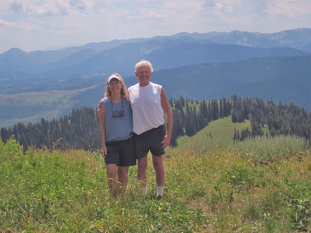
The North Island is less mountainous than the South Island but is more marked by volcanism. There are too many fault lines in NZ to count! It was quiet and peaceful and has a bazillion coves and inlets. 14 miles across the Cook Strait, the South Island contains the Southern Alps, Fjordlands and Southern Lakes, background for Lord of the Rings. This is one of the most scenic places in the world. We drove through gorgeous miles of peaks and rainforests, looking like Jurassic Park. Waterfalls and rivers and views were plentiful.

NZ is 900 miles east of Australia. Because of its remoteness, it was one of the last lands to be settled by humans. Polynesians settled in the islands around 1300 and became the Maori aboriginals. The Europeans didn’t start showing up in any quantity until the 1850s and are the largest percentage of population today. We found the local “Kiwis” very friendly, courteous, polite, helpful, and gregarious.

During its long isolation, New Zealand developed a distinctive biodiversity of animal, fungal and plant life. Sheep and cattle were everywhere, however there are no wild mammals other than marine mammals. (The only mammals native to NZ are 3 types of bats.) We did see plenty of dolphins and the New Zealand fur sea lions - no whales spotted at this time of year. Birds are so prolific and unique that we were in danger of becoming serious birders! The inexhaustible and unusual bird songs we heard made us laugh out loud. Many seabirds breed in New Zealand with 1/3 of them unique to the country. More penguin species are found in New Zealand than in any other country. We saw the Yellow-eyed penguin, the rarest of all penguins and found only in Southern New Zealand. Another treat was the Northern Royal Albatross at Taiaroa Head of Otago Peninsula, which is the only place in the world where they breed on land (where humans are.) You can see from one of our photos the size of their wingspan (up to 10 feet.) The country’s mascot, the Kiwi, is extremely difficult to see as they are nocturnal and shy. They are critically endangered since they are flightless and are easy to pick off by introduced predators, including dogs.

The food was delicious, and tips and taxes are already included which we think would be great if we adopted that.  No tipping anywhere! In addition to the wildlife, the Fjordlands NP was the highlight of the trip. The Fjordlands have steep mountains and deep fjords and is breathtakingly beautiful. The West Coast region has a very high rainfall due to the prevailing northwesterly wind pattern and the location of the Southern Alps, which give rise to heavy precipitation. The Fiordlands gets the most rain; Milford Sound averages 268"/year, being the wettest inhabited place in New Zealand and one of the wettest places in the world. It can rain 10" in 24 hours. There are 14 fiords along the 134 miles of Fiordland coastline. We had an overnight cruise on Doubtful Sound, only accessible by boat, which may be the most beautiful place we’ve ever been to. It was foggy with heavy rain (not uncommon) our first day and the storms were really wonderful to experience. The next day was sunny and clear so we got to experience it both ways. The rain made waterfalls triple in size and number.

NZ is long and narrow, 990 miles N to S and at its widest 250 miles. In square miles it is the size of Colorado. The population is 4.5 million, with ¾ living on the smaller North Island. The country is largely rural and over 50% of the population lives in the 4 largest cities.

We were there during the Rugby World Cup that New Zealand’s “All Blacks” team won. They begin each game with the Maori warrior haka challenge which is more than a little intimidating.
https://www.youtube.com/watch?v=IqfHv9FOpXw The passion of the fans may exceed NFL standards! We learned a little about rugby and found ourselves getting caught up in the outcome. It is a fun sport to watch.

We traveled via boat, train, airplane, foot, and mostly by driving rental cars. We loved driving through small towns and past the gorgeous remote or agricultural terrain, and past the snow-crested peaks of their many mountains. Keep left! Sometimes the journey can be better than the destination. New Zealand was utterly gorgeous and a fantastic trip.


On to Australia where we spent November, post to follow soon.